
Our original intention was to present the state of research on open agglomerations in the territory of the Czech Republic besides the site of Němčice which is generally known and which is presented separately in the present proceedings. However, this objective took very soon quite an unexpected twist in that we rather quickly ended up asking ourselves quite basic questions such as: what makes a settlement an agglomeration? What characteristics (formal, functional, or both) define them? Can we talk about agglomerations as a single well defined concept or rather about a multitude of models of settlement complexity? To try to answer these, we will first make an overview of sites of Moravia and Bohemia (cf. tab. 1; fig. 1) which can be in one way or another compared with ‘agglomerations’ as published in Fichtl & Barral 2019.

Moravia
The term agglomeration is clearly applicable to Němčice nad Hanou (hereafter referred to as Němčice)1. Apart from it, there is no site in Moravia that can be unequivocally labelled in this way2.
A buffer of sites has been identified around Němčice, some of them also referred to as agglomerations and some of them with evidence of coin production.3 Most of them have a long settlement history with occupation from LT A to LT D but all information on them comes from surface surveys (mostly using metal detector).
The only completely excavated site in Moravia, considered at the time of its exploration to be a centre, is Bořitov4 (LT C2–D1; 2 ha, 14 pit houses) located some 40 km west of Němčice separated from the Morava lowlands by the hills of Drahanská vrchovina. It yielded finds of bronze vessels fragments and a finger-ring originally with a gemstone, traces of iron and bronze working, and possibly whet-stone production, as well as finds of raw amber, otherwise rare on open settlements5. However, within the range of 2 km there are three more sites6 from LT C2–D1 and only 800m away were detected traces of a LT B2–C1 settlement with bronze, gold (crucible), and iron working7. In any case, the entire cluster of sites is incomparable (in extent and wealth) to the situation of Němčice and its surroundings.
Němčice is about 120 km as the crow flies to the north-east from the comparable agglomeration in Roseldorf8 (Lower Austria). Both sites are located in the so-called Amber route corridor, an area including the eastern zone of the Middle Danube region (Moravia, Upper Silesia, the eastern part of Lower Austria, and the westernmost part of Slovakia). Based on the monetary system and the distribution of glass objects, this area also had a specific local identity, with presumably one central power9.
| Site | Chronology (LT) | Method | Surface (ha) | Settlement structure | Specialised Production | Coin presence | Coin production | Long-dist. contacts | (previous) cemetery | |||
| Field-walking | Excavation | Geophysics | Metal detecting | |||||||||
| MORAVIA | ||||||||||||
| Bořitov | C2–D | p | p | × | × | 2 | Nucleated? | – iron working – bronze – whet-stone | ? | × | p | × |
| Břeclav region | C1–D1 | p | × | × | p | >1500 | Scattered | × | pp | p | p | p |
| Břeclav-Žleby | >10 | Nucleated | bronze | pp | p | × | p | |||||
| Mistřín | C | × | p | × | × | >1 | Nucleated | – pottery; – bronze / gold | ? | × | p | p |
| Němčice | (B2) C1–C2 | p | × | p | pp | 40 | Nucleated + smaller sites around | – glass – bronze | ppp | p | p | × |
| Neředín | A(–D1) | × | p | × | × | 9 | Nucleated | – pottery (LT A) – iron smelting (LT A) | ? | × | × | × |
| Polešovice | A(–D1) | × | p | × | × | >8 | Nucleated | – amber (LT A) | p | × | p | × |
| BOHEMIA | ||||||||||||
| Lovosice | (? )C2–D | × | p | × | × | 60? | Nucleated? | quern stones | ? | ? | p | p |
| Mšec I | B2–C1 | p | × | × | × | 16 | Nucleated witihin a scatter of smaller sites | – iron smelting – sapropelite | ? | × | p | ? |
| Mšecké Žehrovice I | 10 | |||||||||||
| Mšecké Žehrovice II | 6,6 | |||||||||||
| Prague Bubeneč | C1 –D1 | × | p | × | × | 40 | Nucleated? | iron smelting | p | ? | × | p |
| The site in the Slaný region | B1–D | × | × | × | p | 10–15 | Nucleated +smaller sites around | sapropelite | p | Coin die | p | × |
| Žehuň | (A–) C2–D | p | p | × | p | >12 | Nucleated? | ? | p | × | p | × |
In the middle of the distance between these two centres lies one of the best studied regions in the Czech Republic – the Břeclav region. A number of La Tène period sites were uncovered here by traditional archaeological methods during the construction, among other things, of a dam at the end of the 1970s and in the 1980s in an area of about 5×25 km. Most of them were small settlements on low elevations along the watercourses10. Some of them have been published in detail11. The picture obtained from the excavation suggests rather rural settlements (with sparse evidence of craft specialisation such as iron processing, pottery production in pottery kilns, and non-ferrous metal casting), with extremely few metal finds. No coins at all are known from these traditional archaeological excavations. This is in stark contrast to the new finds obtained with the help of metal detectors12, which even helped to identify some larger sites (like Drnholec – over 8 ha13). Production of metal artefacts in the region was probably decentralized, as evidenced by its numerous traces (crucibles, touchstones, production waste) at lowland sites14. A concentration of sites (along with coin finds) has been detected in some areas in the vicinity of Břeclav15. Sites are located there at a short distance from each other and we can speak about a clusters of sites with similar spectra of metal finds dated mainly to LT C–D1. A similar situation was described in Lower Austria16 and western Slovakia17 where sites with significant quantities of coins of identical types are located on the eastern bank of Morava. The Morava River apparently did not mark a frontier between two economically independent areas; quite on the contrary it was an important axis of communication connecting the left and right bank into a single unit. Relatively numerous coins were found – and to some extent documented – in a number of sites in the immediate surroundings of Břeclav and in a broad zone along the Morava right bank up to the Hodonín district. Only a fraction of them have been published18.
The locality of Žleby east of the town of Břeclav yielded at least several hundred coins (but based on the available information this number could be up to several times higher). Less than one hundred of them have been documented in detail.19 The site is located near the built-up area of the town of Břeclav and it is not clear whether another settlement is not overbuilt by the modern town.
When comparing the coin spectrum from the Břeclav region with the far more numerous assemblage from Němčice20, the nature of coins circulating in both regions in LT C1–C2 does not seem to have been much different21. The steady reduction of the weight standard of the Amber route corridor coinage over time allows us to follow the intensity of coin circulation, which peaked in both areas probably in LT C2. At this point the golden stater standard weight was around 8 g and the silver obol standard weight around 0.7 g (tab. 2 and 3).
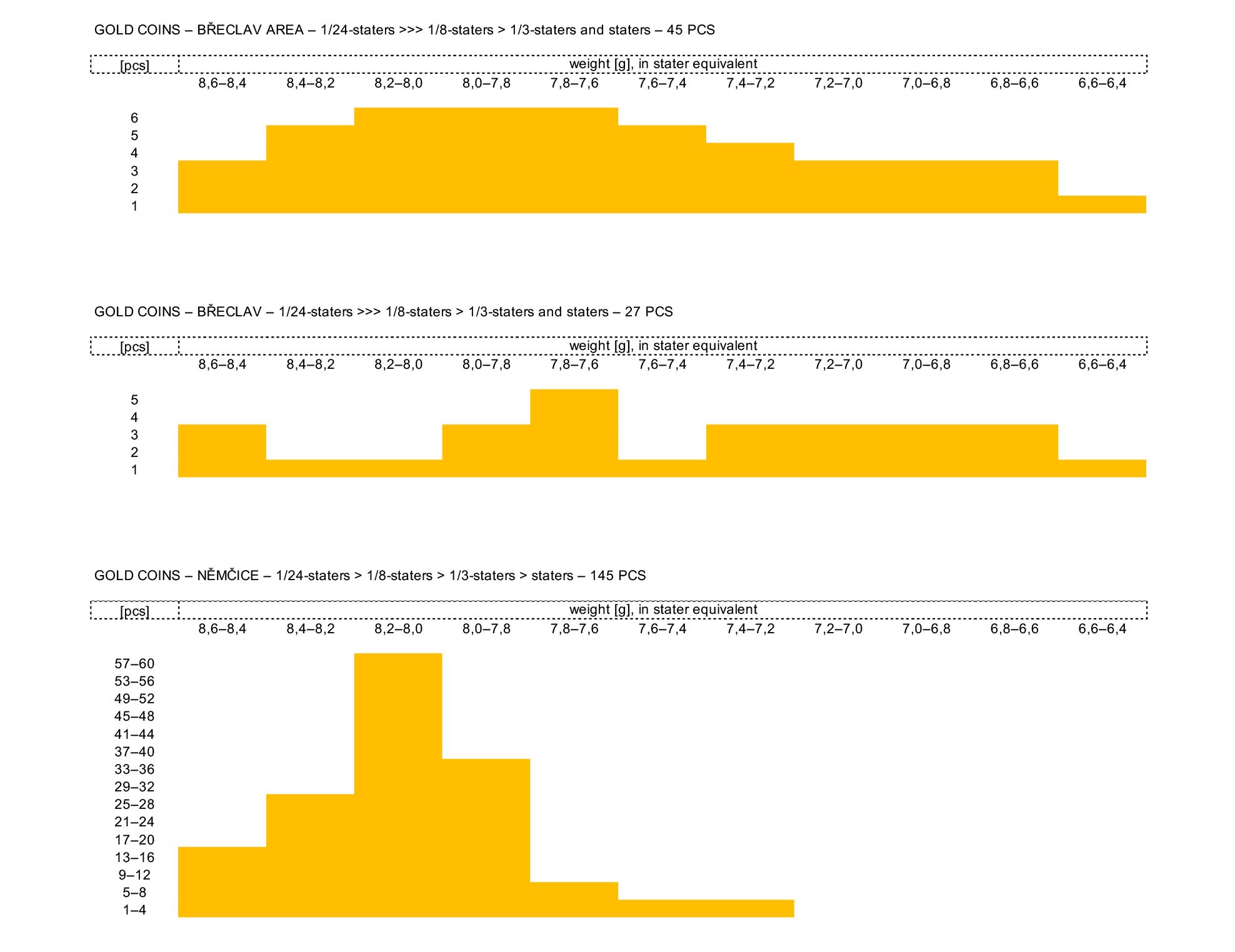
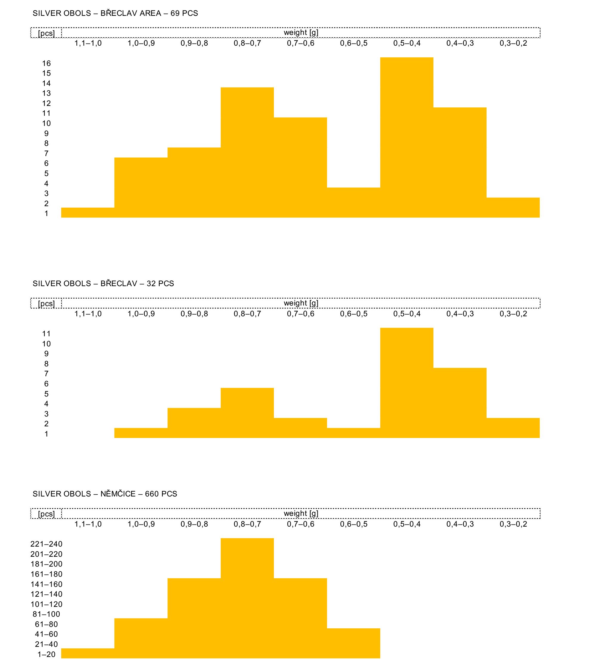
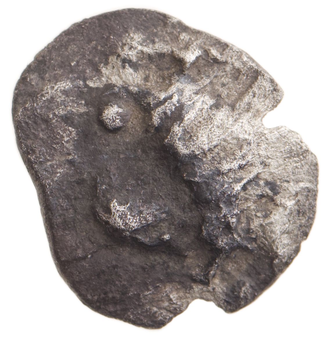
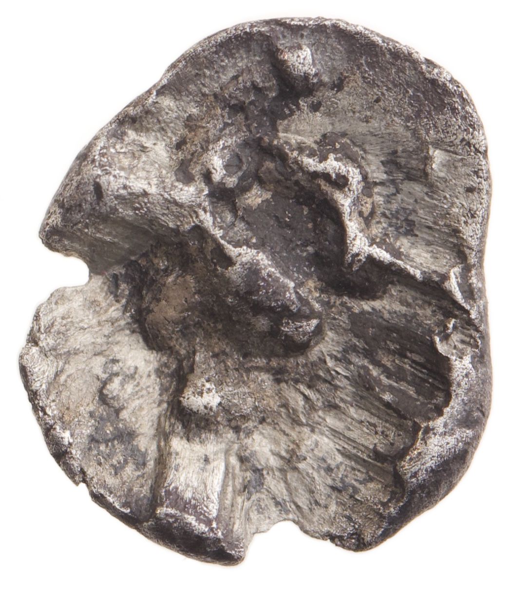
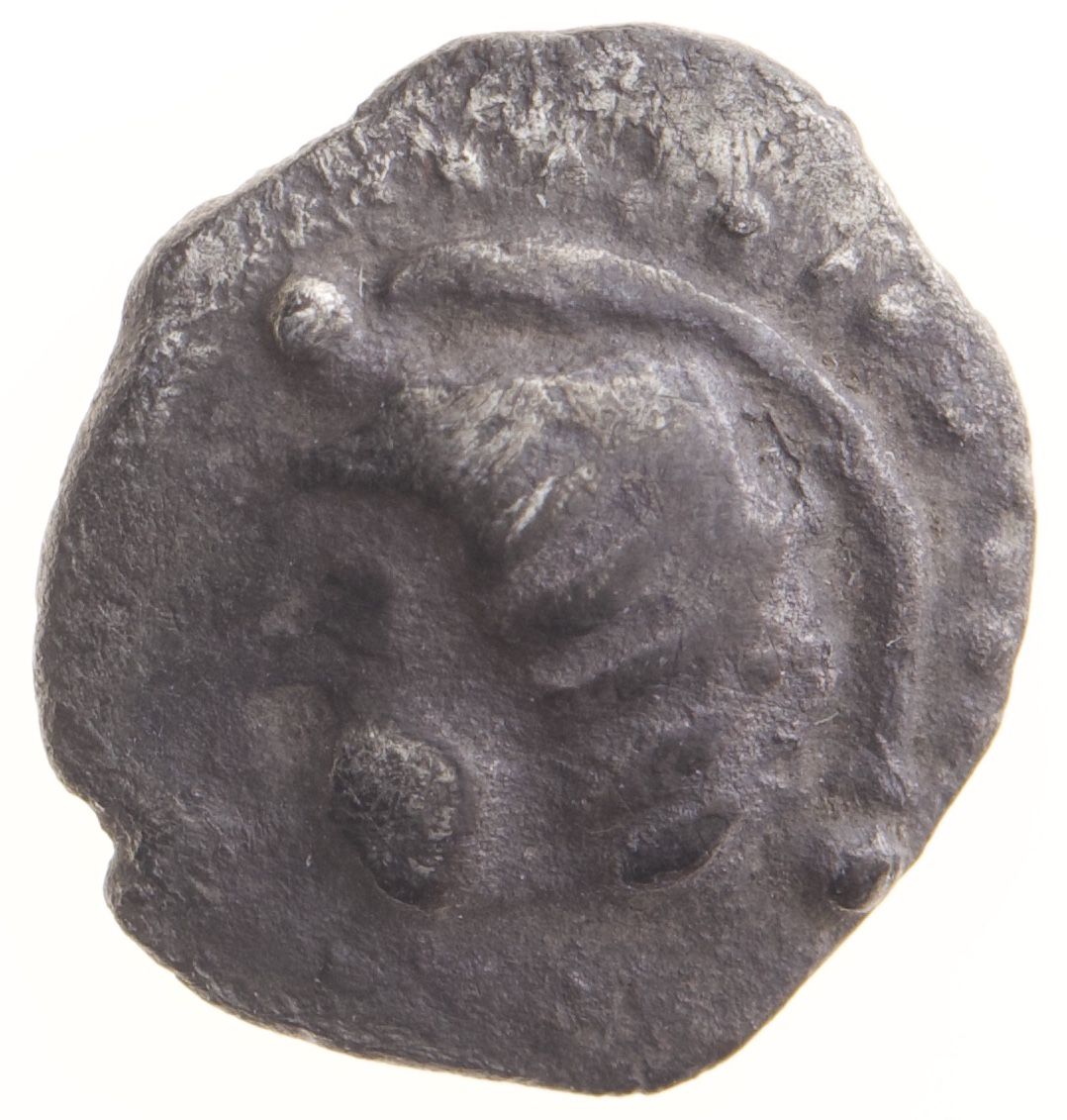
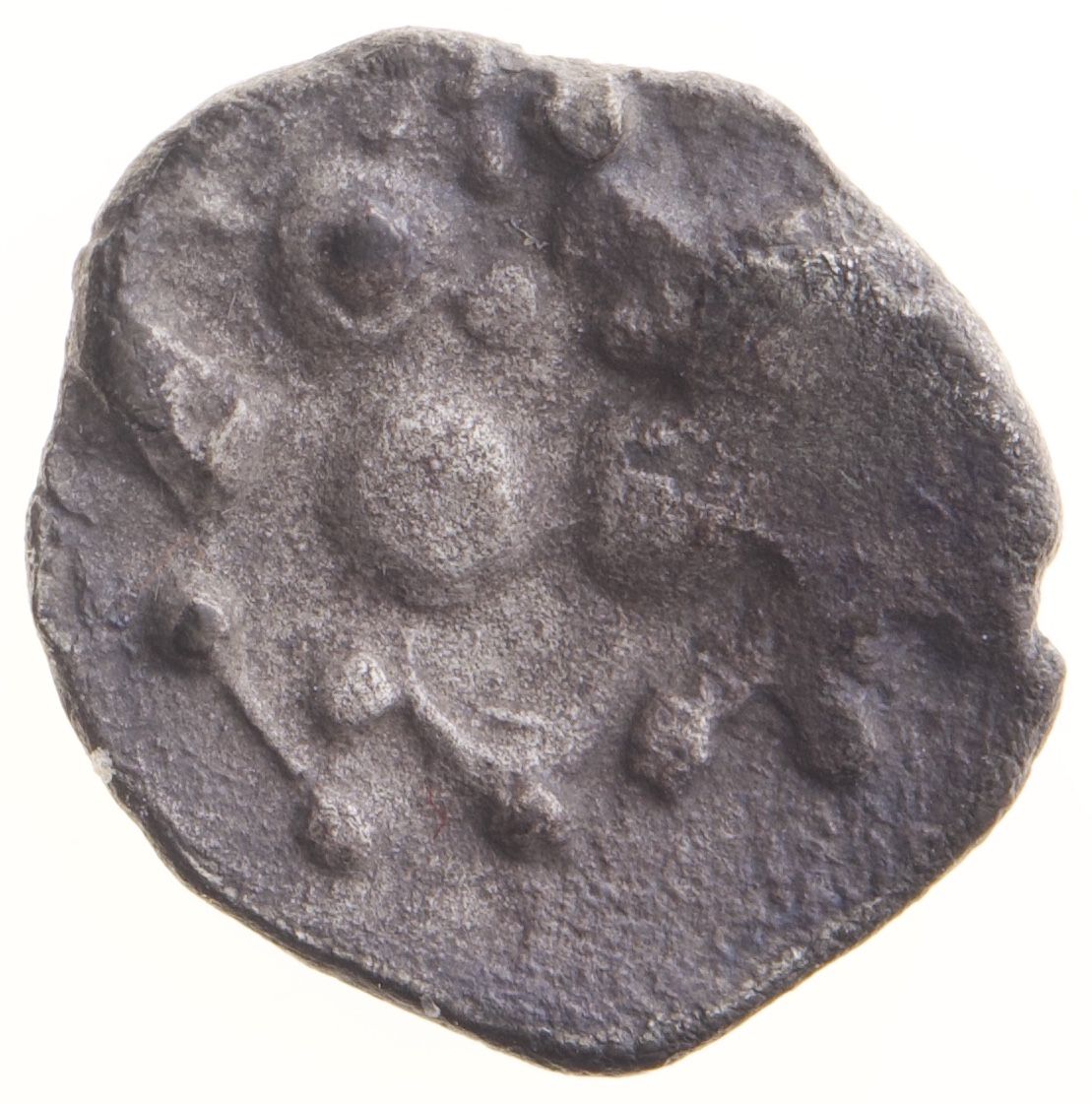
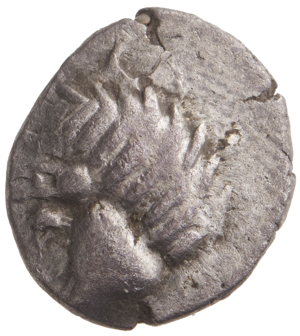
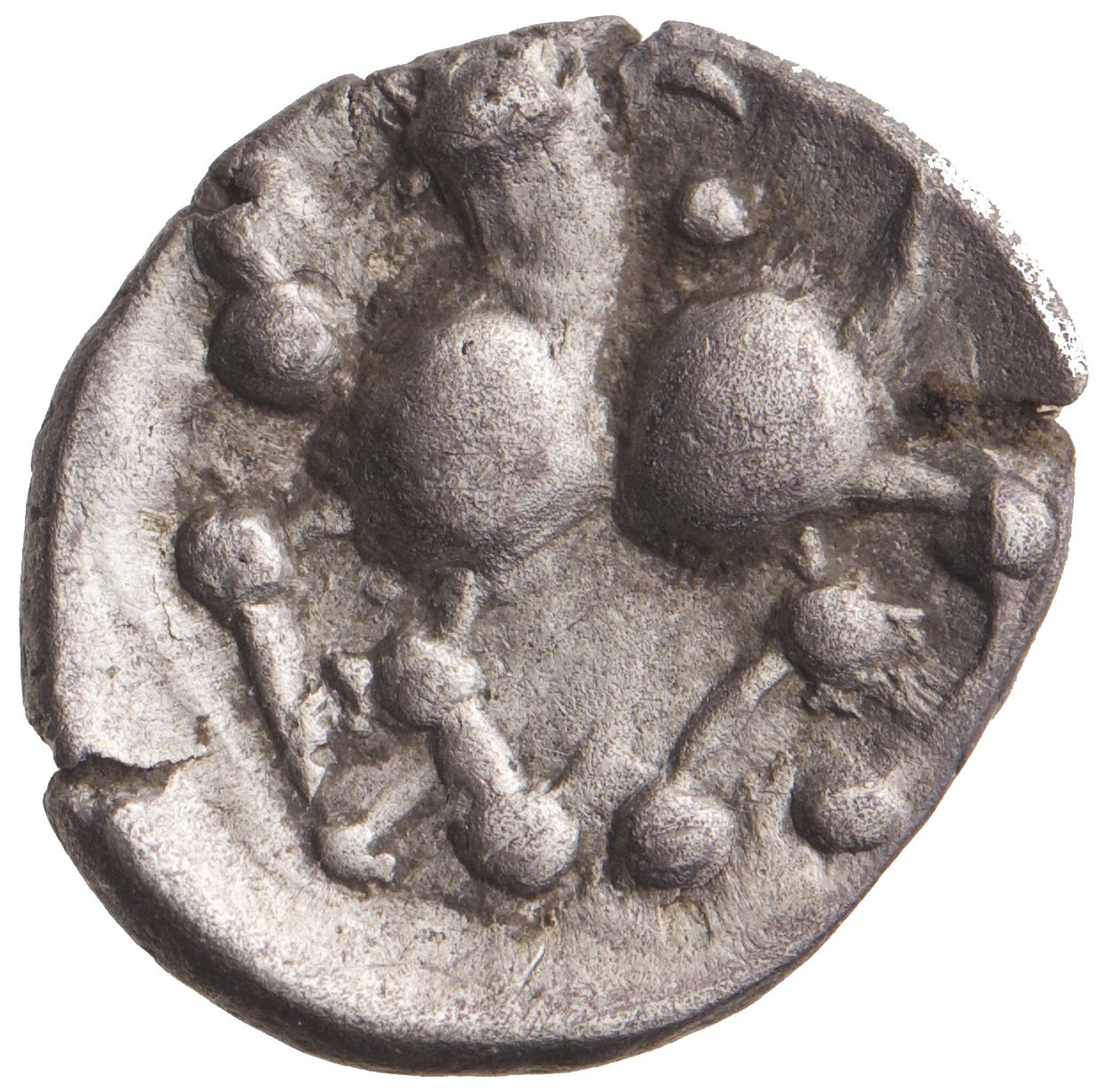
Later probably still within the period of LT C2 the coin circulation in Němčice dropped surely due to decline of the site. On the contrary, the still intense coin circulation in Břeclav region testifies to continuity of occupation. The available data on the ‘post-Němčice period’ in the Břeclav region shows a considerable decrease in gold coin circulation while at the same time the intensity of circulation of silver obols increased (tab. 2 and 3). The comparison of coin finds in Břeclav region and in Břeclav itself is very telling: it shows a relative increase in intensity of both gold and silver coin circulation in Břeclav in the ‘post-Němčice phase’ in contrast with the situation in the region as a whole. It is still in this phase that finds of some specific varieties of golden 1/24-staters of the type Staré Hradisko and of silver obols of type Břeclav (fig. 2) concentrated at Břeclav. They are most likely local issues; in this way, local coin production can be suggested even though we still lack any direct evidence of it.
|
 |
 |
 |
 |
 |
Compared to neighbouring areas, the Břeclav region stands out due to a striking concentration of anthropomorphic figurines, otherwise attested mainly at Němčice22. We do not yet have evidence from the Břeclav region of a large agglomeration like Němčice, but the abundance of finds is suggestive of a different, but still densely occupied settlement network.
Further to the northeast in the Morava valley in the direction to Němčice, the settlement in Mistřín (at least 1 ha in size) with assumed production of a specific type of pottery and finds of crucibles with traces of gold smelting was traditionally attributed the role of a centre23. It can be associated with a burial site 100 m away with at least 37 graves24. Sites with numerous coins and glass finds (and presumed concentration of inhabitants) were located also in this region25. However, all of these sites are known only from surface surveys and the settlement extent is unknown.
The important sites in the Morava valley also certainly include the settlement in Polešovice (with the identified extent of at least 8 ha), which yielded evidence of continuous occupation from Ha D to LT D, dozens of features, and evidence of large scale amber working. The excavated features are aligned into a sort of ‘street’, implying thus a planned settlement (at least in the case of its excavated part); however, the site still awaits a detailed study26.
Bohemia
In Bohemia, our knowledge of the sites of Lovosice27 and Prague-Bubeneč28, explored mainly by urban rescue excavations, is still extremely fragmentary.
In the microregion of Mšec in central Bohemia, N. Venclová famously defined – based on her 1980s fieldwalking and some small-scale excavations29 – the concept of ‘an industrial zone’, i.e. a region in which a series of settlements without conspicuous evidence of mutual hierarchy are dedicated to specialised production of some kind. This specific case however requires a few hindsight remarks: out of the detected sites, three attain a surface area exceeding 5 ha (Mšec I – 16 ha, Mšecké Žehrovice I – 10 ha, Mšecké Žehrovice II – 6.6 ha). N. Venclová, however, did not take the settlement size into consideration to declare them (central) agglomerated sites for reasons of methodological rigour (uncertainty whether the detected surface area reflects a single phase or several phases combined). Also, the lack of settlement hierarchy may be only apparent: the methods of the period (simple field walking without the use of metal detector and small-scale excavation) made it almost impossible to obtain the types of artefacts which could be used as a proxy for considerations on such topics (coins, metal and glass in general).
The site of Žehuň in eastern Bohemia was investigated by a series of metal detector surveys organised by the Institute of Archaeology of the Czech Academy of Sciences following previous plundering of the site30. The site has delivered a sizeable assemblage of coins and bronze artefacts and was interpreted as an agglomerated site of a middle size and middle rank in the settlement hierarchy31. Even though this interpretation is surely highly probable, our full understanding of the site’s functioning is strongly hindered by our total ignorance of the settlement system within which it operated (no other settlement site of the period is sufficiently investigated and published in the immediately surrounding region) and also by the condition in which the site was preserved. Located at the bottom of an artificial lake and accessible for only a very short period each year, the site is out of the reach of most standard archaeological research methods (geophysics and large scale excavations) and we cannot even be sure of its actual size32. Consequently, the site’s internal organisation and nature of its structures will probably never be understood and no archaeobotanical data will be obtained.
Almost two hundred individual coin finds are attested at Žehuň, most of which have been documented and published33. The relatively high number of finds is due to proactive approach towards the relatively small group of people plundering the site and to repeated controlled metal detector survey organised by the Institute of Archaeology of the Czech Academy of Sciences. As a result, we may assume that most of the coins discovered have been documented. The spectrum of coin finds from Žehuň demonstrates coin circulation mainly in the period of LT C2–D1. The silver obol is the dominant denomination while circulation of gold coins is documented only scantily (tab. 4 and 5). The highest intensity of monetary circulation is related to obols weighing around 0.6-0.5 g, which are typical for the very end of the Němčice coin assemblage34 (tab. 3).
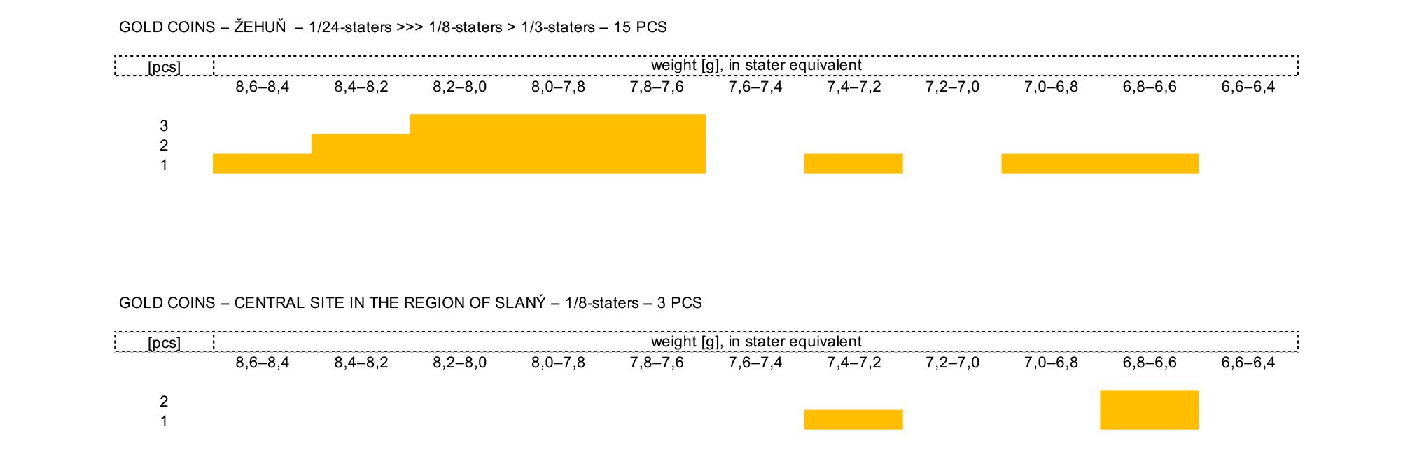
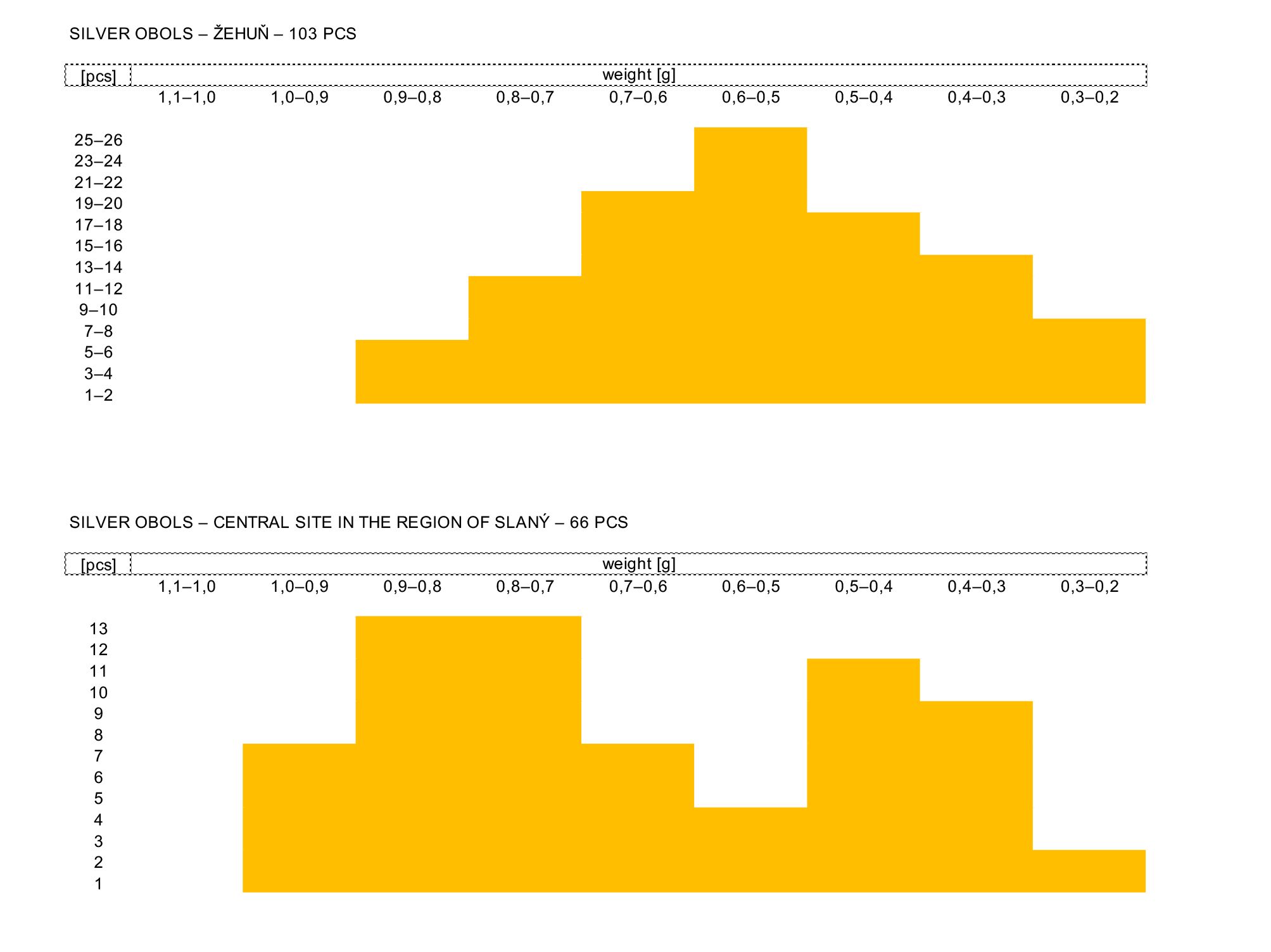
A series of settlement sites was identified in the region of Slaný in central Bohemia, not far from the Mšec region. Its publication is in preparation but identity is kept secret for the moment in order to protect it from plundering. All the evidence comes from private metal detector surveys of a single individual diligently documenting the find circumstances thanks to which the dispersal of information characteristic of other sites was avoided. The central site with the surface of 10-15 ha was occupied from LT B1 to LT D (with only negligible size variation). Four small-size settlements (a couple of hectares at the most) were detected within roughly 2 km perimeter from the central site. In terms of activities carried out in the settlements our possibility of understanding them is once again hindered by the fact that all evidence comes from surface surveys, mostly metal detecting. Still, most evidence – no matter how numerous – suggests activities with some traces of sapropelite working, rare evidence of bronze smelting, and most interestingly a find of a coin die.
Over one hundred coins are known to have been found at the site, the vast majority of them have been documented and awaiting publication. The site has been the continuously monitored and it seems not to have been subject to uncontrolled pillaging. The find spectrum attests coin circulation probably already from LT C1 up to LT D1. With a few exceptions only silver obols are attested at the site with the circulation intensity reaching two peaks at the level of 0.9-0.8 g and 0.5-0.3 g (tab. 5). The available evidence thus suggests that the dynamics of coin circulation at the site is perfectly opposite from Žehuň.
For LT C period in Bohemia, both sites are – based on the available evidence – the richest in evidence of coin circulation. However, when comparing the number of coin finds from these most important Bohemian sites to the far larger assemblages from Břeclav and mainly Němčice, it seems that – regardless of the state of evidence – the intensity of coin circulation was notably lower in Bohemia than in the corridor of the Amber route. In contrast to Němčice and Břeclav there is also a clear lack of sites with significant evidence of LT C coin circulation in the immediate surroundings of both Bohemian central sites. In Bohemia, the number of coin imports is significantly lower, also the circulation of gold coins seems to have been much less intense – silver obol seems to have been the absolutely dominant denomination in Bohemia. Therefore, the available numismatic evidence suggests that Bohemia and Moravia differed so much35 that it seems very difficult to integrate them into a single overarching scheme.
Discussion
In both Bohemia and Moravia region no Late Iron Age sites have been recently excavated to a considerable extent. In the last years only sections of settlements have been explored (and excavations of larger sites made it rarely into a complete publication). There is a complete lack of large-scale excavations and geophysical surveys of entire ‘landscape sections’ related to La Tène period occupation36. The predominant source of information are now finds from metal detector surveys. The different methods employed to explore a settlement create different pictures and our ideas about various sites are thus often conditioned by the period in which and the method by which they were investigated.
However, finds from detector surveys alone cannot provide us with contextual information concerning the site (or the character of the settlement). For example, for a series of chain-belt production waste in Čejkovice37 we do not know how large the site is. In the case of smaller collections of metal finds38 we cannot rule out their provenance from burials.
Metal detecting can also skew the picture as it favours finds of large artefacts made of non-ferrous metals while iron is ignored by most detectorist. However, (to cite one example only) more than 80% of the 698 La Tène brooches found in the excavations at the oppidum of Staré Hradisko were made of iron39; these would be completely overlooked by metal detectors in the most commonly used settings. At Němčice only 25% of the brooches found during the non-systematic metal detector surveys were made of iron, compared to 50% of iron brooches yielded by systematic surveys aimed at all metals40. On the contrary, traditional archaeological excavation without the use of a metal detector can create a different bias: a false image of an exclusively rural settlement (see supra the Břeclav region). It seems that only a combination of field walking (including with metal detector), excavation, and geophysics can provide a full picture.
The data may also be distorted by artefacts specific for particular periods. Sites dated to LT C are indicated in metal detector finds by hundreds of chain-belt components41, which, apart from coins, are one of the main find categories of both ‘large and medium’ agglomerations (Němčice and Žehuň – cf. supra). But how to recognize in the detector finds an agglomeration from LT A – from the time when coins were not minted and metal objects were much less numerous and less bulky? Can we talk about agglomeration in the case of the settlement of Olomouc-Neředín42, investigated by a series of small-scale excavations on an area of 9 ha, from where we have evidence of specialized production (iron smelting, wheel-turned and graphite-tempered pottery), raw materials indicating long distance contacts (amber), and prestige goods (painted pottery, ceramic beaked flagon)? What could indicate an agglomeration from LT B1?
Final thoughts
The recent synthesis of the agglomeration phenomenon already clearly showed its complexity and the difficulties to classify it43. Classification by size may prove elusive for a number of reasons (let us realize, that numerous sites recognized as ‘agglomerations’ have the surface area of less than 10 ha, some even less than 5 ha!). A much more ‘human-focused’ classification would be that of the site’s function in which case everybody will gladly agree about the importance of concentrated craft production (and possibly also indices of religious or societal centrality)44. But we end up reading also about sites of primarily trade function, often derived from their ‘location on trade routes’ (how to define what quantity of – potentially – imported goods45 is indicative of their consumption and what of them being traded goods?) and even about primarily agricultural agglomerations. Of course, none of these usages is by itself incorrect – the importance of a site (if ‘agglomeration’ is actually meant to mean ‘site of significance’ or ‘central site’) may be signalled by any of these indices. The problem is that once this label can be stuck to any site based on any single criterion mentioned above (size – all as 5 ha is enough – OR craft OR trade OR centrality), it quickly loses analytical and even descriptive value. With a slight – and fully intentional – exaggeration we might say that ‘open agglomeration’ is in current usage any non-fortified site that archaeologists finds interesting for one reason or another.
We have the impression that we are getting here into the same kind of trouble as with the ‘oppida’: we are constructing an artificial (and unfortunately somewhat prestigious) category based on vague criteria. We isolate these sites from the landscape in which they were created and from the settlement system they were a part of. Moreover, keeping deep in our minds the ‘unity of the Celtic world’, we tend to assume, that this artificial category corresponds to the same thing from the Atlantic to the Carpathians.
Do not misunderstand us: we recognize that the entire ‘agglomeration phenomenon’ is a manifestation of a transformation which the La Tène culture societies were undergoing… We believe however, that it is much more interesting to study the complexity of the phenomenon than to flatten it into a single ill-defined catch-all term46.
Our suggestion instead is adopting rather a bottom-up approach: though not completely rejecting the significance of agglomerations (whatever we mean by that term), we should not study them in isolation from the landscape and the settlement system they were a port of. Let’s start by studying the activities carried on in each settlement available; let us ask, to what extent they were overlapping or exclusive of only some of them; and only then, let us reconstruct the relations (in terms of size, functional complementarity, and potentially hierarchy) between the settlements and within the regional economical systems; let us – first of all – not suppose that they will be identical from one region to the other; and only in the final step let us ask what labels to use for the different levels of settlements we identify in this process. It is very likely that for some of these we may use the term ‘agglomeration’ and let us do it happily… keeping in mind however, that it by itself does not help us to understand much.
Bibliography
- Bedáň, L. (2021): Opasky z mladší doby železné ve střední Evropě [Late Iron Age belts in Central Europe]. Manuscript of Master Thesis. Department of Archaeology and Museology, Faculty of Arts, Masaryk University [online] https://is.muni.cz/th/fy2l5/?lang=en
- Bursák, D. and Kacl, P. (2017): “The La Tène Lowland Agglomeration in Prague-Bubeneč in Perspective of Latest Research”, in: Kysela, J., Danielisová, A. and Militký, J., eds., Stories that made the Iron Age. Studies in Iron Age Archaeology dedicated to Natalie Venclová. Praha, 475-503.
- Čižmář, I. and Danielisová, A. (2021) : “Central Sites and the Development of Rural Settlements from the Middle to Late La Tène Period in Central Moravia”, Památky archeologické, CXII, 197-236.
- Čižmář, M. (1984): Laténské sídliště z Velkých Hostěrádek, okr. Břeclav [Die latènezeitliche Siedlung aus Velké Hostěrádky, Bez. Břeclav], Památky archeologické, LXXV, 463-485.
- Čižmář, M. (1987): Laténské sídliště ze Strachotína, okr. Břeclav [Eine latènezeitliche Siedlung aus Strachotín, Bez. Břeclav], Památky archeologické, LXXVIII, 205-230.
- Čižmář, M. (2002): Vývoj laténského osídlení v oblasti pod Pavlovskými vrchy [Entwicklung der Besiedlung in der Latène-Zeit im Gebiet der Pollauer Berge], in: Stuchlík, S., ed., Oblast vodního díla Nové Mlýny od pravěku do středověku. Spisy Archeologického ústavu AV ČR Brno, 20, Brno, 249-271.
- Čižmář, M. (2003): Laténské sídliště v Bořitově/ Latènezeitliche Siedlung in Bořitov, Pravěk, Supplementum 10, Brno.
- Čižmář, M., Čižmářová, J. and Meduna, J. (2018): Němčice a Staré Hradisko. Spony / Němčice und Staré Hradisko. Fibeln, Brno.
- Čižmář, M., Kolníková, E. and Noeske, H.-C. (2010): “Němčice-Víceměřice – ein neues Handels- und Industriezentrum der Latènezeit in Mähren”,Germania, 86/2008, 655-700.
- Čižmářová, H. (2021): “Současný stav poznání skleněného šperku doby laténské na Moravě” [The current state of knowledge of La Tène glass ornaments in Moravia], Archeologické rozhledy, LXXIII, 228–258.
- Čižmářová, J. (2017): Keltská pohřebiště na Moravě. Okresy Hodonín, Kroměříž, Olomouc, Opava, Prostějov, Přerov, Uherské Hradiště, Zlín/ Keltische Gräberfelder in Mähren. Bezirke Hodonín, Kroměříž, Olomouc, Opava, Prostějov, Přerov, Uherské Hradiště, Zlín, Brno.
- Danielisová, A., Kysela, J., Mangel, T., Kyselý, R. and Militký, J. (2018): “Iron Age site in Žehuň, Central Bohemia. An open settlement with central functions”, Památky archeologické, CIX, 127-178.
- Elschek, K. and Kolníková, E. (2014): “Beitrag zur Datierung der latènezeitlichen Zentralsiedlung von Zohor in der Westslowakei. Kleinfunde, keltische und frührömische Münzen”, in : Čižmářová, J., Venclová, N. and Březinová, G., eds., Moravské křižovatky. Střední Podunají mezi pravěkem a historií. Brno, 353-375.
- Fichtl, S. and Barral, P. (2019): “Conclusion. Quelques réflexions sur les agglomérations celtiques de La Tène moyenne et finale”, in: Fichtl, S., Barral, P., Pierrevelcin, G. and Schönfelder, M., eds., Les agglomérations ouvertes de l´Europe celtique (IIIe – Ier s. av. J.-C)/Offene Großsiedlungen im keltischen Europa (3.-1. Jh. v. Chr.). Mémoire d‘Archéologie du Grand Est 4, Strasbourg, 439-450.
- Geršl, J. (2022): Osídlení dolního Podyjí v době laténské [Settlement of Lower Thaya during the Late Iron Age], Manuscript of Master thesis, Department of Archaeology and Museology, Faculty of Arts, Masaryk University, [online] https://is.muni.cz/th/b4l08/?lang=en
- Goláňová, P. (2018): The Early La Tène Period in Moravia, Studien zur Archäologie Europas 32, Bonn.
- Goláňová, P. and Hlava, M. (2021): Something went wrong: on the bronze chain-belt rejects from Čejkovice (Hodonín district, CZ), Slovenská archeológia – Supplementum 2, 121-127.
- Goláňová, P. and Kysela, J. (2019): What can the dwarfs tell? On settlements and anthropomorphic statuary in La Tène Southern Moravia, Studia Historica Nitriensia 23 Supplementum, Sedem kruhov Josefa Bujnu, Nitra, 71-92.
- Goláňová, P., Komoróczy, B., Kmošek, M., Kolníková, E., Vlach, M. and Zelíková, M. (2020): “New metal and glass finds from the Late Iron Age in South Moravia (CZ). The contribution of citizen science to knowledge of the La Tène settlement structure in the Břeclav Region”, Přehled výzkumů, 61/2, 9-41.
- Hlava, M. (1998): “Laténské sídliště v Bořitově-Mezichlumí”, Pravěk Nová řada, 7 (1997), 333-358.
- Holzer, V. (2014): “Roseldorf – An Enclosed Central Settlement of the Early and Middle La Tène Period in Lower Austria (Roseldorf/Němčice Centre)”, in: Fernández-Götz, M., Wendling, H. and Winger, K., eds., Paths to Complexity: Centralisation and Urbanisation in Iron Age Europe, Oxford, 122-131.
- Kolníková, E. and Koháček, R. (2009): “Nové keltské mince z južnej Moravy” [New Celtic coins from south Moravia], Numismatický sborník, 24, 309-316.
- Komoróczy, B., Vlach, M., Zelíková, M., Sedláček, J. and Růžičková, P. (2019): “Revize stavu archeologických komponent v trati Drnholec „Holenická pole“ pomocí prospekčních a málo známých invazivních výzkumných metod” [Revision of archaeological components on the site Drnholec “Holenická pole” in South Moravia via various non-destructive or lesser invasive methods], Přehled výzkumů, 60/2, 9-56.
- Kysela, J. (2020): Things and Thoughts. Central Europe and the Mediterranean in the 4th–1st centuries BC, Studia Hercynia, monographs 1, Praha.
- Kysela, J., Kmošek, M. and Smělý, T. (2021): “Kučeravá Starohradišťanka. K umění a řemeslu na mladolaténské Moravě” [Ye curly lass from Staré Hradisko. On art and craft in Recent La Tène Moravia], Přehled výzkumů, 61/1, 79-90, [online] https://doi.org/10.47382/pv0621-06
- Lečbych, M. (2022): “Polešovice (okr. Uherské Hradiště). „Nivy“, trasa D55”, Přehled výzkumů, 63/1, 189-191.
- Ludikovský, K. (1964): “Dílny na moravských nížinných keltských sídlištích” [Les ateliers aux habitats celtiques moraves situés dans la plaine], Archeologické studijní materiály, 1, 126-134.
- Meduna, J. (1980a): Die latènezeitlichen Siedlungen in Mähren, Praha.
- Meduna, J. (1980b): “Die latènezeitlichen Siedlungen und Gräberfelder in Mähren (Katalog)”, Fontes Archaeologiae Moravicae, XI, Brno.
- Militký, J. (2018a): Keltské mincovnictví ve 3. a 2. století před Kristem v Čechách [Keltisches Münzwesen im 3. und 2. Jahrhundert vor Christus in Böhmen]. Praha.
- Militký, J. (2018b): “Celtic coins from the central site of Žehuň” [Keltské mince z areálu centrálního sídliště v Žehuni], Památky archeologické, CIX, 179-231.
- Salač, V. (1990): “K poznání laténského (LTC2–D1) výrobního a distribučního centra v Lovosicích” [Zu Untersuchungen über ein latènezeitliches (LT C2–D1) Produktions und Distributionszentrum in Lovosice)], Archeologické rozhledy, 42, 609-639.
- Salač, V. (2000): “Lovosice in der Latènezeit, römischen Kaiserzeit und Völkerwanderungszeit”, in: Bouzek, J., Friesinger, H., Pieta, K. and Komoróczy, B., eds., Gentes, Reges und Rom. Auseinandersetzung – Anerkennung – Anpassung. Festschrift für Jaroslav Tejral zum 65. Geburtstag. Spisy Archeologického ústavu AV ČR Brno 16, Brno, 155-163.
- Salač, V. (2023): “Keltische Zentren, Oppida und Städte in Böhmen und umliegenden Landschaften”, in: Bofinger, J. and Stegmaier, G., eds., Städte der Kelten. Urbane Zentren der späten Eisenzeit. Archäologische Informationen aus Baden-Württemberg, 86, 182-203.
- Smělý, T. (2017a): “Numismatische Spur des bislang verkannten Siedlungszentrums in der Region von Břeclav, Südmähren”, in: Kysela, J., Danielisová, A. and Militký, J., eds., Stories that made the Iron Age. Studies in Iron Age Archaeology dedicated to Natalie Venclová, Praha, 505-521.
- Smělý, T. (2017b): “One Authority – One Idea – One Order. The Monetary System of the Amber Road as a Testimony of Greek Influence on Social and Economic Activities of central European Celts”, Studia Hercynia, 21(2), 40-80.
- Smělý, T. (2020): “Moravský horizont českého předstradonického mincovnictví – svědectví o ovládnutí Čech moravskými elitami” [Moravian horizon of Bohemian pre-Stradonice coinage – evidence of Moravian elites taking over control of Bohemia], in: Čižmář, I., Čižmářová, H. and Humpolová, A., eds., Jantarová stezka v proměnách času, Brno, 635-674.
- Trebsche, P. (2016): “Structuration et planification des agglomérations laténiennes en Basse-Autriche”, in: Blancquaert, G. and Malrain, F., eds., Évolution des sociétés gauloises du Second âge du Fer, entre mutations internes et infuences externes, Actes du 38e colloque de l’AFEAF, Revue archéologique de Picardie Numéro spécial 30, Senlis, 363-375.
- Trebsche P., ed. (2020): Keltische Münzstätten und Heiligtümer. Die jüngere Eisenzeit im Osten Österreichs (ca. 450 bis 15 v. Chr.), Wien.
- Venclová, N., eds. (2001): Výroba a sídla v době laténské. Projekt Loděnice [Production and settlement in the La Tène period: The Loděnice project, central Bohemia], Praha.
- Venclová, N. and Militký, J. (2014): “Glass-making, coinage and local identities in the Middle Danube region in the third and second centuries B.C.”, in: Hornung, S., ed., Produktion – Distribution – Ökonomie. Siedlungs- und Wirtschaftsmuster der Latènezeit, Akten des internationalen Kolloquiums in Otzenhausen, 28.–30. Oktober 2011, Universitätsforschungen zur prähistorischen Archäologie, 258, Bonn, 387-406.
Notes
- Čižmář et al. 2010; Čižmář et al., infra, https://una-editions.fr/agglomeration-centrale-de-nemcice.
- Cf. most recently Salač 2023, Abb. 8.
- Klenovice, Polkovice, Hrubčice, Držovice: Čižmář & Danielisová 2021; Čižmářová 2021.
- Named ‘petite village’ by P. Trebsche (Trebsche 2016) and ‘rural settlement’ by J. Kysela (Kysela 2020).
- Čižmář 2003, 30, 37; Kysela 2020, 294, 352.
- Bořitov – Perná/Nivky, Bořitov – Býkovice (‘Podnivničí‘), Černá Hora – Zaryplovy (cf. Čižmář 2003, Abb. 25).
- Bořitov – Niva/Zádvoří (Hlava 1998).
- Holzer 2014.
- Venclová & Militký 2014; Smělý 2017b.
- Čižmář 2002.
- Strachotín – 13 pithouses: Čižmář 1987; Velké Hostěrádky – 23 pithouses: Čižmář 1984.
- Smělý 2017a; Goláňová & Kysela 2019; Goláňová et al. 2020.
- Komoróczy et al. 2019.
- Goláňová & Hlava 2021, 124-125, fig. 3.
- Goláňová et al. 2020; Geršl 2022.
- Trebsche ed. 2020, 51-54.
- Elschek & Kolníková 2014.
- Kolníková & Koháček 2010; Goláňová et al. 2020.
- Smělý 2017a.
- Kolníková 2012.
- Smělý 2017a.
- Kysela et al. 2021, fig. 4.
- Meduna 1980a, 156, Taf. 80-92; 1980b, 182-190, Taf. 54-55; cf. Ludikovský 1964.
- Čižmářová 2017, 92-109, 207-224, Tab. 9-24:1-11.
- For glass e.g. Strážnice (34 fragments of glass bracelets, perhaps even their local manufacture), Čejč (33 glass bracelet fragments); both sites are in Hodonín district: Čižmářová 2021.
- Lečbych 2022.
- Salač 1990; 2000.
- Bursák & Kacl 2017.
- Venclová 2001.
- Danielisová et al. 2018; Militký 2018b.
- Along the lines of Trebsche 2016.
- 12 ha have been established as the minimum surface area but we cannot be sure how much remains covered by the muddy lake sediments.
- Militký 2018b.
- Cf. Smělý 2020.
- This difference is obvious already on the level of coin production. Bohemia to a large extent shares denomination system and the basic weight standard with Moravia but unlike the highly precise Moravian coinage, in Bohemia both weight standard and purity of metal are approached with a large dose of anarchy. Also the extremely variegated coin type production in Bohemia contrasts with a single large scale centralised production in Moravia (Smělý 2017b; Militký 2018a; Smělý 2020).
- Cf. Malrain, infra, https://una-editions.fr/des-campagnes-maitrisees.
- Goláňová & Hlava 2021.
- Goláňová et al. 2020.
- Cf. Čižmář et al. 2018, 37.
- Čižmář et al. 2018, 15.
- Cf. Bedáň 2021.
- Goláňová 2018, 220, figs 16, 62, 69.
- Fichtl et al. 2019.
- Of which we do not have evidence in the Czech lands – once again with the obvious exception of Němčice.
- Fichtl & Barral 2019, Fig. 2.
- Attempts at hierarchisation are of course not absent (Trebsche 2016).